This final term I have learnt that I can distinguish between different phrasal verbs and also between the three conditionals.
What I liked most was the work of La Palma
I think I did the best in Geography.
But I also have to improve my speaking
Showing posts with label GEOGRAPHY GLOSSARY. Show all posts
Showing posts with label GEOGRAPHY GLOSSARY. Show all posts
Monday, 19 June 2017

TERTIARY SECTOR
VOCABULARY
WELFARE STATE:
HIGHWAYS ROUTES:
SUBWAY:
TRADING BLOCKS:
JOBS IN 3 SECTOR
TOURISM
TRANSPORT
TRADE
TELECOMMUNICATIONS
WELFARE STATE:
HIGHWAYS ROUTES:
SUBWAY:
TRADING BLOCKS:
JOBS IN 3 SECTOR
TOURISM
TRANSPORT
TRADE
TELECOMMUNICATIONS
SECONDARY SECTOR
VOCABULARY
RAW MATERIAL:
INDUSTRIAL ROCKS:
POLLUTION:
TIDE:
STRIKE:
CONCRETE:
RELEASE: give
RAW MATERIAL:
INDUSTRIAL ROCKS:
POLLUTION:
TIDE:
STRIKE:
CONCRETE:
RELEASE: give
Monday, 29 May 2017
Friday, 31 March 2017
PRIMARY SECTOR
SELF COMSUPTION: activities done for one´s own benefit
IRRIGATED CROPS: crops that are watered with mechanised systems
NON IRRIGATED CROPS: crops watered with rain water
PLOTS: area of a land
POLYCULTURE: different crops at the same time in a plot
MONOCULTURE: only one type of crop in a plot
YIELD: amount produced
ITINERANT FARMING: farmers who grow crops in a another location due to a soil losing its
richness
GREENHOUSE: glass or plastic building for growing crops
SNUFF: powderedm tobacco
FORESTRY:

LIVESTOCK:

MINING:

FISHING:

AGRICULTURE:

AGRICULTURE VOCABULARY
SORGHUM
QATS
SISAL
YAM
PALM OIL
SUGAR BEET


FISHING VOCABULARY
SNAFF
HAKE
TUNA
HARRING


LIVESTOCK VOCABULARY
CAPRINE
OVINE
BOVINE
CATTLE
PORCINE


FORESTRY VOCABULARY
BIRCH
BEECH
MAPLE
OAK
MAHOGANY
CEDAR
EBONY
TEAK
HEVEA


IRRIGATED CROPS: crops that are watered with mechanised systems
NON IRRIGATED CROPS: crops watered with rain water
PLOTS: area of a land
POLYCULTURE: different crops at the same time in a plot
MONOCULTURE: only one type of crop in a plot
YIELD: amount produced
ITINERANT FARMING: farmers who grow crops in a another location due to a soil losing its
richness
GREENHOUSE: glass or plastic building for growing crops
SNUFF: powderedm tobacco
FORESTRY:
LIVESTOCK:

MINING:

FISHING:
AGRICULTURE:
AGRICULTURE VOCABULARY
SORGHUM
QATS
SISAL
YAM
PALM OIL
SUGAR BEET

FISHING VOCABULARY
SNAFF
HAKE
TUNA
HARRING
LIVESTOCK VOCABULARY
CAPRINE
OVINE
BOVINE
CATTLE
PORCINE
FORESTRY VOCABULARY
BIRCH
BEECH
MAPLE
OAK
MAHOGANY
CEDAR
EBONY
TEAK
HEVEA
Tuesday, 28 March 2017
SELF ASSESMENT
This term I have learnt that I can distinguish between different phrasal verbs and also between adjectives with -ing and -ed
What I liked most was the exercices of football in P.E and the proyect of Cameroon
I think I did well in P.E
This term I didn´t do anything outside the class. I need to improve my fluency because it´s difficult for me to speak.
About culture I have learn that sometimes you think that there are the same expressions in other countries but usually thre are misunderstandings and we also learnt about countries in Africa
What I liked most was the exercices of football in P.E and the proyect of Cameroon
I think I did well in P.E
This term I didn´t do anything outside the class. I need to improve my fluency because it´s difficult for me to speak.
About culture I have learn that sometimes you think that there are the same expressions in other countries but usually thre are misunderstandings and we also learnt about countries in Africa
Sunday, 19 March 2017
PROJECT OF CAMEROON
MARIO MARTÍN SICILIA 3B
UNAI ARIZKUREN ANDRÉS 3C
http://prezi.com/2iw4gmzok6qq/?utm_campaign=share&utm_medium=copy
Wednesday, 15 March 2017
AGRICULTURAL LANDSCAPE EXERCISE

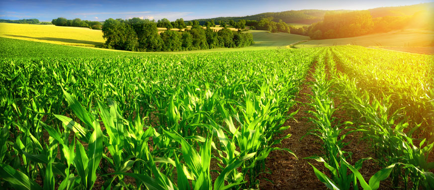
This agricultural landscape has large plots with a regular shape.
The borders are open fields.
The farming system :
Monoculture because there are a variety of plots and each with its own crops
I think there is an irrigated farming because the plots are very green and very large.
It is an extensive agriculture because the area has a lot of land. And they probably need to use machinery.
Thursday, 9 March 2017
UNIT 4 STATE AND NATIONS
STATE: political unit made up of a territory with boundaries a permanent population and identifying
symbols
STATES INSTITUTIONS:
the police/the armed forces/the diplomatic corps/public officials and civil servants
NATIONS: people with a common language, religion, culture usually having the same state although
there are nations without any such as the palestinians
MONARCHY: where a king or a queen rules the country but only in part
DICTATORSHIP: ruled by one leader with all the control
DEMOCRACY: the citizens decide who represent them politically
OLIGARCHY: only a small group of people has the power and the rights
THEOCRACY: when people think god is the authocracy
ANARCHY: there are no rules
Soain has a democracy and the state is a parliamentary monarchy but the king has no power.
there are 3 powers in our state
- executive power
- legislative power
- judicial power
symbols
STATES INSTITUTIONS:
the police/the armed forces/the diplomatic corps/public officials and civil servants
NATIONS: people with a common language, religion, culture usually having the same state although
there are nations without any such as the palestinians
MONARCHY: where a king or a queen rules the country but only in part
DICTATORSHIP: ruled by one leader with all the control
DEMOCRACY: the citizens decide who represent them politically
OLIGARCHY: only a small group of people has the power and the rights
THEOCRACY: when people think god is the authocracy
ANARCHY: there are no rules
Soain has a democracy and the state is a parliamentary monarchy but the king has no power.
there are 3 powers in our state
- executive power
- legislative power
- judicial power
Sunday, 15 January 2017
EXERCISES OF AFRICA
EXERCISE 1
1. WHERE IN THE WORLD IS ÁFRICA?
2. HOW MANY TIMES IS ÁFRICA LARGER THAN THE UNITED STATES?
3. HOW IS THE SAVANNA DEFINED IN THE VIDEO IN THE VIDEO?
4. WHICH ANIMALS CAN BE FOUND IN THE SAVANNA BIOME?
5. WHERE IS LOCATED THE CHAPARRAL BIOME IN ÁFRICA?
6. WHICH ARE THE MOST FAMOUS DESERTS IN ÁFRICA?
7. THE MAIN NATURAL RESOURCES MENTIONED IN THE VIDEO ARE....
1. IT´S IN THE SOUTH OF EUROPE AND IN THE SOUTHWEST OF ASIA
2. AFRICA IT´S THREE TIMES LARGER THAN THE UNITED STATES
3. THE SAVANNA IS A WIDE OPEN GRASSY PLAIN WHICH COVERS NEARLY HALF OF
AFRICA AND IS CHARACTERIZED BY SCATTERED TREES AMONG A LANDSCAPE OF
GRASSES AND SHRUBS.
4. MANY OF THE SPECIES FOUND IN AFRICA CAN BE SEEN IN THE SAVANNA BIOME
LIKE GIRAFFES OR ELEPHANTS
5. IT IS IN THE NOTHERN COAST OF AFRICA
6. THE SAHARA DESERT, THE NAMIB DESERT AND THE KALAHARI DESERT.
7. BODIES OF WATER, DESERTS AND ELEVATED ZONE.
EXERCISE 2
1. AFRICA RUNS 5000 MILES FROM THE MEDITERRANEAN SEA ALL THE WAY DOWN TO THE CAPE OF GOOD HOPE AND 4600 MILES FROM CAPE VERDE ALL THE WAY OVER TO THE SOMALIA
2. BIOMES ARE CLIMATE ZONES AND THROUGHOUT THAT AREA,THROUGHOUT THAT REGION, YOU CAN SEE THE SAME AVERAGE TEMPERATURE AND AVERAGE PRECIPITATION WHAT THAT MEANS IS THAT YOU ALSO SEE VERY SIMILAR PLANTS AND ANIMALS LIVING IN THAT REGION
3. THE MOST FAMOUS DESERT IN AFRICA IS, OF COURSE, THE SAHARA DESERT. NOW SOME PARTS OF THE SAHARA DESERT ARE SANDY, LIKE YOU CAN SEE HERE. OTHER PARTS OF THE SAHARA DESERT ARE ROCKY BUT IN EITHER CASE, THE FACT THAT IT IS VERY DRY IS GOING TO MAKE IT A VERY DIFFICULT BARRIER TO CROSS.
4. IT IS NOT JUST THE RAIN ITSELF THAT´S PARTICULARY IMPORTANT, IT´S ALSO THE BIODIVERSITY. THERE ARE MANY DIFFERENT PLANTS AND ANIMALS SPECIES THAT CAN BE FOUND IN THE RAINFOREST AND THAT`S ONE THING THAT MAKES THE RAIN FOREST SO VALUABLE NOT JUST IN AFRICA BUT THROUGHOUT THE EARTH
5. THE NILE IS THE MOST FAMOUS RIVER IN AFRICA, BECAUSE IS THE LONGEST RIVER IN THE WORLD. BUT THERE IS ALSO THE CONGO WHICH IS THE NINTH LONGEST RIVER IN THE WORLD
6. AFRICA ACTUALLY HAS ITS OWN VERSION OF THE GREAT LAKES WITH FAMOUS LAKES LIKE LAKE MALAWI, LAKE VICTORIA, LAKE KIVU AND LAKE TANGANYKA
7.ALL THE AFRICA IS A PLATEAU. MEANING THAT AFRICA ITSELF IS AN ELEVATED LAND.BUT THAT DOESN´T MEAN YOU CAN´T FIND ANY MOUNTAINS IN AFRICA. YOU CAN FIND MOUNTAIN RANGES LIKE, FOR EXAMPLE THE ATLAS IN NORTHWESTERN AFRICA
8.AFRICA ALSO HAS SOME INTERESTING MOUNTAINS LIKE MOUNTAIN KILIMANJARO, THE HIGHEST PEAK IN AFRICA WHICH SEEMS TO JUST RISE ON IT OWN OUT OF THE GROUND
9. THE GREAT RIFT VALLEY REFERS TO A REGION OF AFRICA THAT IS LITERALLY, BEING SPLIT APART. THERE ARE SOME TECTONIC PLACS THAT ARE LOCATED WITHIN OR NEAR AFRICA, THAT ARE, ACTUALLY MOVING AWAY FROM EACH OTHER, AND WHAT´S DOING IS CREATING NOT JUST SOME OF THE HIGHEST ELEVATION IN AFRICA, BUT ALSO LAKES LIKE TANGANYKA THAT IS AMONG THE DEEPEST IN THE WORLD.
Sunday, 18 December 2016
UNIT 3 POPULATION
Famine: shortage of food
Steep: having an almost vertical slope or angle.
Soil: a country, land, or region
Low-lying: lyng near sea level or the ground surface
Sparsely: thinly scattered or distributed
Unevenly: not level or flat
Investment: the investing of money in order to make a profit
Display: to show or exhibit
Figures: a symbol for a number
Axis: the line around which a rotating body, as the earth, turns
Drought: a long period of dry weather
Barren: not producing offspring
Conurbation:a large urban area, resulting from the expansion of several cities into each other
Megalopolis: a group of cities linked together by a transport network
Sunday, 20 November 2016
VALLADOLID SCHOOL TRIP
SCHOOL TRIP TO VALLADOLID
On the 2nd of November we had a school trip to Valladolid to visit The Wine Museum, The Peñafiel Castle and and to enjoy a contemporanean musical concert. When we arrived the teachers allowed us to go around the main square, it was great because we stayed together. Then we went to the theatre to see the concert, I didn´t like so much but well....
Later we went to Peñafiel to see the Wine Museum and the castle to learn about the wine and see the castle inside, We went up the sairs of the castle and in a room I thought I was seeing people but they were mannequins, it was funny.
Finally we took the bus to come back home.

On the 2nd of November we had a school trip to Valladolid to visit The Wine Museum, The Peñafiel Castle and and to enjoy a contemporanean musical concert. When we arrived the teachers allowed us to go around the main square, it was great because we stayed together. Then we went to the theatre to see the concert, I didn´t like so much but well....
Later we went to Peñafiel to see the Wine Museum and the castle to learn about the wine and see the castle inside, We went up the sairs of the castle and in a room I thought I was seeing people but they were mannequins, it was funny.
Finally we took the bus to come back home.
Thursday, 27 October 2016
GEOGRAPHY: DESCRIBE A LANDSCAPE
This landscape is situated in La Palma, Canary Islands. It is a subtropical climate (temperate zone).
The summers are hot and the winters are mild because it is a island and it is surrounded by the ocean
It never rains ( in summer ) but in the months of January, February and March usually rains. Due to the influence of the Mediterranean climate, it has wet winters.
La Palma has got two small rivers in la Caldera de Taburiente, a mountain arch with a crater shape, and they have regular flow. Forests in this zone are made up of evergreen trees such as canary island pines and dragos. Fauna: there are grajas, La Palma giant lizard, Western Canary Isands goldcrest, pinzón pamero, paeriforme. La Palma has also characteristics of Mountain landscapes because there are more than 2500 metres altitude in some areas with very low temperatures.
PICTURE
At the background you can see the typical sea of clouds over the mountains of La Palma, You can see the green vegetation and the blue sky
I have chosen this place becouse I like it and I´m half canarian.


 SEAGULL
 DOVE TURKEY
LAUREL FOREST

The summers are hot and the winters are mild because it is a island and it is surrounded by the ocean
It never rains ( in summer ) but in the months of January, February and March usually rains. Due to the influence of the Mediterranean climate, it has wet winters.
La Palma has got two small rivers in la Caldera de Taburiente, a mountain arch with a crater shape, and they have regular flow. Forests in this zone are made up of evergreen trees such as canary island pines and dragos. Fauna: there are grajas, La Palma giant lizard, Western Canary Isands goldcrest, pinzón pamero, paeriforme. La Palma has also characteristics of Mountain landscapes because there are more than 2500 metres altitude in some areas with very low temperatures.
PICTURE
At the background you can see the typical sea of clouds over the mountains of La Palma, You can see the green vegetation and the blue sky
I have chosen this place becouse I like it and I´m half canarian.

DRAGON TREE
CANARY ISLAND PINE
TIZON LIZARD
SEAGULL DOVE TURKEY LAUREL FOREST
Subscribe to:
Posts (Atom)